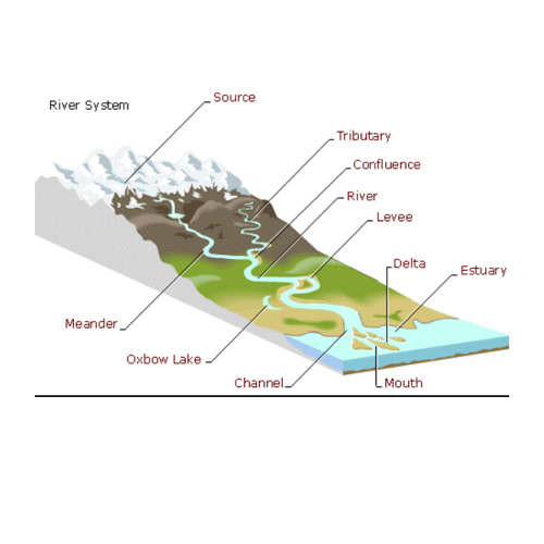
geography models
 Glacial Landscape
Shows the landscape before and after glacial action, size 75x100 cms.
read more...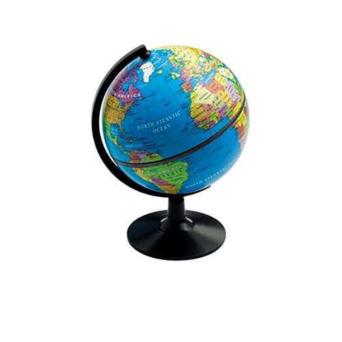 geographical globe
Geographical globe with political boundaries and plastic graduated arc. Marked in English language.
read more...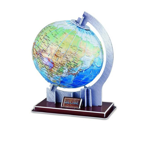 globe model of earth
Showing the layers inside the Earth with 7 detachable parts showing the interiors of Earth. Different colours for different layers. When upper crust is removed, inner core with layers can be seen. When layers one by one are removed you can find the periphery of each layer.
read more...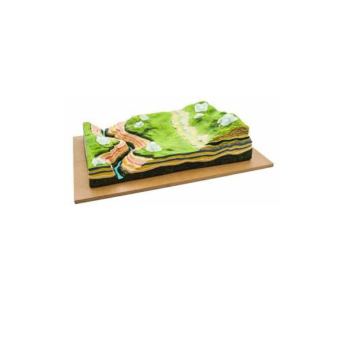 horizontal starta
Shows realistic illustration of lateral stream erosion and weathering. Underlying layers are shown in cross section.
read more...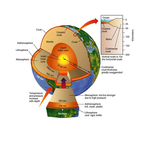 interior of the earth
Showing inner and outer material & formation of the earth, size 75x100 cms.
read more...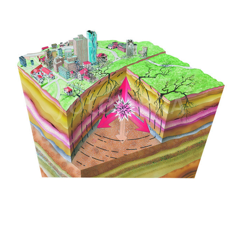 model earth quake
Showing the origin, motion produced and the effects of earth quakes. Various types of seismic waves are also shown, size 75x100 cms.
read more...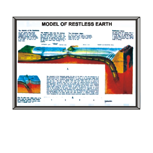 model of restless earth
Showing sea floor spreading with the formation of crust, subduction zones, the interior of the continents and the Mid Ocean ridges, size 75x100 cms
read more...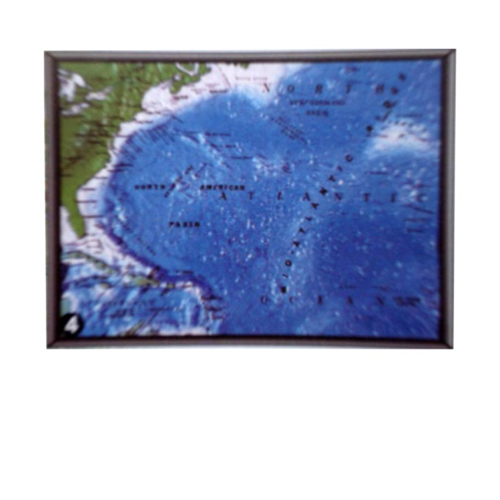 ocean feature model
Relief map of North Atlantic Ocean shows typical portion of ocean floor. It is easy to identify all the major Ocean Features. Size 45 x 60 cms.
read more...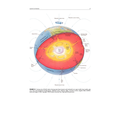 origin of the earth
Showing the various stages through which the earth was formed, size 75x100 cms.
read more... geographical model/maps
For investigation of Geographical and Geological features eight Land form Models joint to form a continuous 3' x 3' model and provides the Mountains, Lakes, Rivers, Deserts, Glaciers, Coastlines, Canyons and Cultural Point.
read more...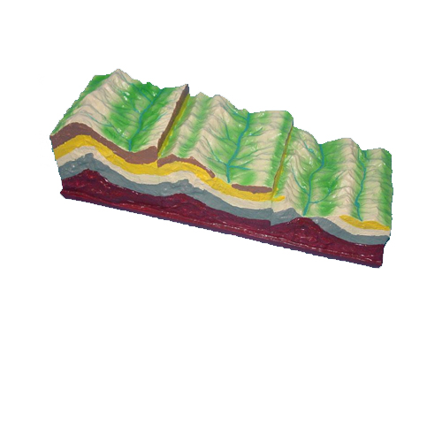 geological and geographical models
These model are of very high quality made of organic composite material (synthetic rexine) with color ink sprayed , bright colours and rigidness. We offer :
model of island formation
fold & fault model(folding tectonic and its land form evolution)
fault model(diastrophism model)
fold model (diastrophism demo model)
model of plate tectonics and land form development
fold, fault & volcano model
model for contour map interpretation
fault folding demo model
folding , tectonic & land form evolution model
model of volcano
 Geographical Apparatuses And Stencil Sets
We offer :
Geographical Apparatuses
Solar Automatic Revolving With CD
Stensil Sets In English Text & Hindi Text
Under Geographical Apparatuses :
Student Planetarium
Solar System Model
standard Time Indicator
Solar & Lunar Eclipses
Phases Of Moon
Apparatus Day & Night
Seasons Apparatus set Of 4 Globes
Sextant Model
Theodolite Model
Under Stencil Sets In English/Hindi Text , we offer :
UNO Type Stencil Set No. 6H
UNO Type Stencil Set No. 9H
 Wall Atlases Maps & Astronomical Charts
These products are widely appreciated for its accurate design, quality, durability and outstanding performance. These find application in electrical component and their control panels. We offer :
Class room maps comparative wall atlas & reference maps of India (maps certified by survey of India & recommended by NCERT)- size (70x100 cms)
Comparative wall atals of world (maps certified survey of India and recommended by NCERT- size (70x100cms)
Changing face of earth - size 50x75 cms
Man & environment series - size 50x75 cms
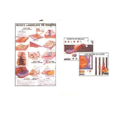
Polyart plastic geographical and astronomical chart series - size (75x100 cms)